
The remnants of a hurricane in the Pacific will bring high winds and heavy rains to southern and central Southeast Alaska Friday.
The storm is called Hurricane Oho, and it’s a cyclone that is moving rapidly across the Pacific toward Southeast Alaska. As of Thursday morning it had maximum sustained winds of 70 miles per hour. However, the storm is forecast to strengthen to near hurricane force by the time it nears the Alaska Panhandle early Friday morning.
“The latest forecast track has it coming, making an approach west of Prince of Wales Island and then tracking kind of along the Southeast Alaska coast, generally northwestward and then finally coming inland over the northeast and eastern gulf coast area north of Cross Sound,” said David Levin, a meteorologist intern at the National Weather Service forecast office in Juneau.
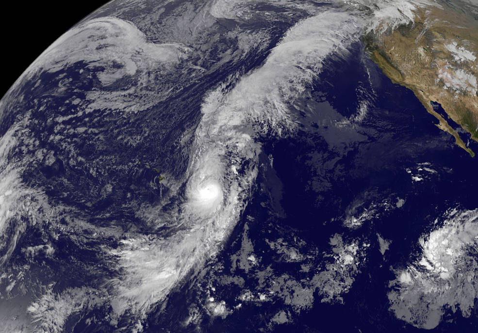
Hurricane Oho appears to have extremely long arms in imagery from NOAA’s GOES-West satellite on October 7.(Photo from the National Aeronautics and Space Administration)
The storm is forecast to bring high winds to the southern Panhandle Thursday night and into Friday morning first near Prince of Wales Island, Ketchikan and Metlakatla and spreading north to Wrangell, Petersburg, Kake, Sitka, Port Alexander by the middle of Friday morning.
“Right now it looks like the strongest winds are going to be over the south in the Craig, Klawock, Ketchikan areas with winds of 40-50 miles an hour but gusting as high as 60-80 miles per hour,” said Levin. “Those winds are also going to be felt in the central Panhandle, Petersburg, Wrangell, Sitka area but more in the lines of 35-45 miles per hour sustained, looking at gusts as high as 55-75 miles per hour especially along the coastal areas as that system moves northwest.”
Heavy rains are also forecast with the hurricane remnants bringing three to four inches in the southern Panhandle. The weather service has issued a high wind warning for the southern part of the region. The storm is expected to near Southeast Alaska early Friday morning and move up the coast and out of the area by later Friday.
The storm is forcing the cancellation of some ferry service in the region. The Inter-Island Ferry Authority has called off Friday’s ferry sailing between Hollis and Ketchikan. The Rainforest Island Ferry is cancelling Friday’s sailing between Coffman Cove, Wrangell and southern Mitkof Island and may cancel Sunday’s service as well. As of Thursday at noon, the Alaska Marine Highway System was not planning any service interruptions because of the storm.


