
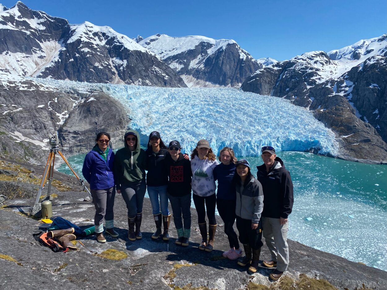
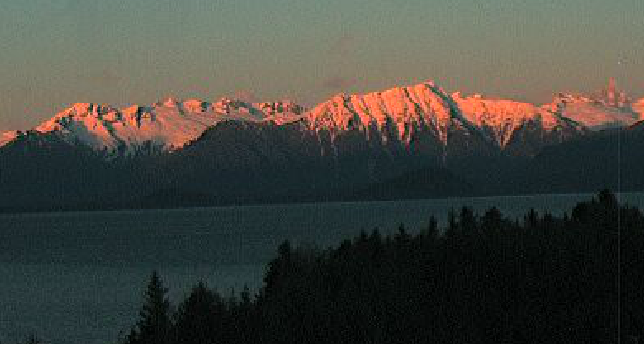
A small group of Petersburg High School students spent Monday night calculating the latest position of the terminus of the southernmost tidewater glacier in the northern hemisphere. They’re part of a decades-long tradition to survey the LeConte Glacier.
High school math teacher TomThompson assigns data points to the sophomores, juniors and seniors gathered to eat pizza and crunch the numbers. Just days before they spent the day recording those points using survey equipment, helicoptered up to spots high up on either side of the steep walled fjord.
Senior Lathum Johnson uses a software design program called Rhino to map out the survey points.
“It kind of shows how far the glacier is receding or if it’s increased since the last time. I guess it’s been really stable over the last few years which is awesome. It’s a lot better than what was happening before,” Johnson said.
“Rhino’s definitely something new that we’ve started doing because at first we had the Forest Service do it,” he said. “So just because the Forest Service is super busy right now, I took a class a couple years ago that’s allowed me to kind of figure this out and doodle on my own. So kind of just working and figuring out as I go, watching YouTube videos and stuff.”
Johnson had a scheduling conflict and was disappointed not to be able to travel to the glacier this year. But he recommends the experience.
“The glacier trip, taking a helicopter up and being able to look at LeConte Glacier is definitely one of the highlights of high school,” Johnson said. “So I totally recommend it for any kids who want to try it out as they’re coming up through middle school and elementary school as something to look forward to and definitely apply for because it’s amazing.”
The students give up their lunchtimes Wednesday throughout the year to learn how to use the surveying equipment and trigonometry they’ll need.
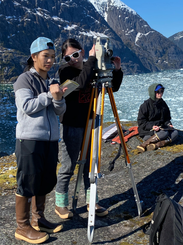
Junior DD Toyomura looks down at a complex drawing of the angles she’s recorded.
“We take angles from the south side to a specific point on the glacier,” Toyomura said. “Then we fly over to the north side and try to find the same point on that side and then take the angle measure of that point. And then since we know the distance between the north side and the south side, we use the law of sines to find the lengths to the point…”
She’s interrupted with a reminder from the teacher on graphing technique.
“After we find the side lengths, we use the law of sines again to find the longitude and departure of that point,” Toyomura continued. “And then we use those vectors to graph it on the graph. And if it lines up about then that’s where we plot that point.”
Part of the challenge is making sure one group on the north side of the fjord and another on the south side are taking a sight on the same spot on the ice face thousands of feet away. And sometimes that point they’ve just recorded breaks off from the glacier and disappears. That only happened with one this year and the students seem pretty happy with the data they collected.
They’re even getting some help from a couple of alumni of the program, Lydia Martin and Julian Cumps, back from college.
“I was invited back just to help out with doing the math again,” Cumps said. “I’ve been working on my computer trying to kind of automate the process, just kind of testing out some different functions and seeing if there’s an easy way to check our work.”
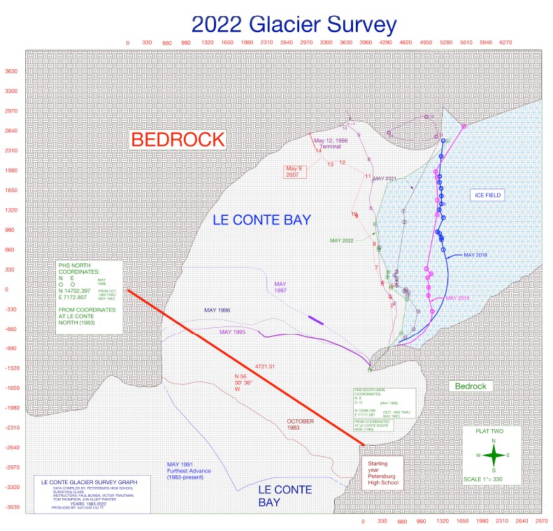
On the desk nearby there are printouts from previous year’s mapping and photos of the teams of prior students who’ve been in the program. It was started in 1983 by PHS teach Paul Bowen and has happened almost every year since then, carried on by other instructors like Victor Trautman and now Thompson.
“It’s such a big glacier when you’re looking at it from our perspective, it’s really hard to see the recession and procession until you really plot the data, because it looks kind of the same and you might realize that it’s moved 500 feet or 1000 feet either way, but what we plotted on Friday could be totally different here on Monday, because even as we were there it calves so much,” Thompson said. “And if anybody’s been out there recently LeConte is full of ice. There’s a lot of ice moving off that thing so it’s, it’s a living body.”
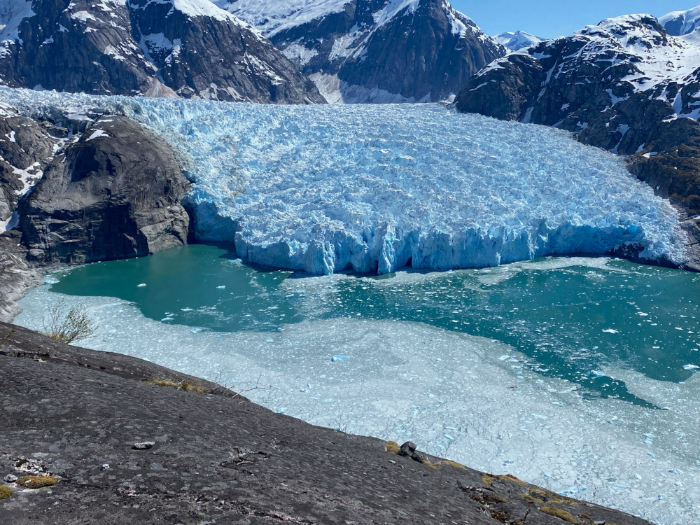
Prior students have documented some big retreats of the ice sheet but it now hits tidewater in a relatively narrower and shallower part of the fjord. It’s position has been somewhat stable in recent years.
For another senior, Leiah Kittams this year was her second surveying the glacier and she was able to lead her group.
“I guess going up a second time I just had more knowledge of what we were supposed to do like setting up and then I guess trying to find the angles in the first place because you have time match up the two different spots from what would be on the north side and what would be on the south side,” Kittams said. “So it’s a lot of like re-imagining where the points are actually at on the glacier.”
Another senior Rose Quitslund helped with calculations last year, but didn’t make the trip to survey the ice until this year. She said it’s a much different perspective than her past experiences.
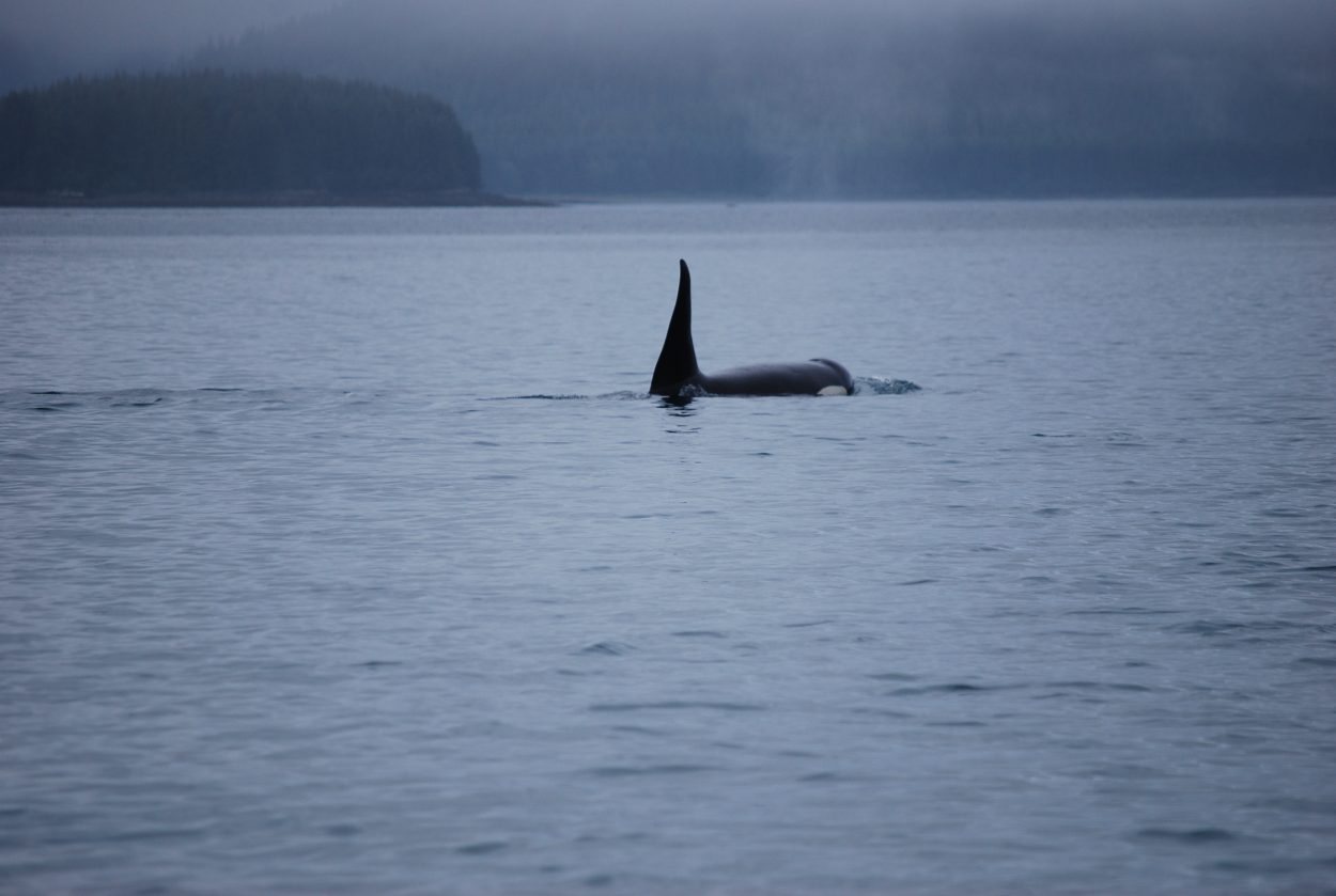
“It’s spectacular,” Quitslund said. “I’ve gone out to the glacier so many times since I was a little kid just going out on the boat with my dad, and it’s such a different experience getting helicoptered out there because the elevation that we’re at it’s about 1200 feet I think and so you can just really see the whole entire glacier and the bay. And it’s like a birds eye view of it.”
The survey captures the ice sheet position at just one point in time – it’s dynamic and can change dramatically from day to day. But they try to do the survey around the same time every year to make a good comparison. This year’s data shows the terminus advanced compared to last year, and it’s also further out in the fjord from positions mapped in 2019 and 2018.


